


Bonjour mes amis!
In our corner of France, a chilled bottle of rosé on the summer table is as ordinary as bread. Still, our American travelers always ask us the same question: why does rosé taste so much better here?
Here, rosé is made intentionally, with 2,600 years invested in its perfection. In Provence, it is most of what the region produces, so the grapes are grown for it, picked early, often at night, and pressed gently to keep the color pale and the flavors delicate. The climate does the rest. Long days of sun ripen the fruit, cool nights preserve the acidity that makes rosé taste fresh, and the mistral wind keeps the vines dry and healthy. Stony limestone soils keep yields low and flavors concentrated, while blends of Grenache, Cinsault, Syrah and Mourvèdre give the dry, elegant style the region is known for.
There is also the pleasure of drinking it at the source. Rosé is best young, and here you taste the latest vintage only a few miles from where it was made, often from small estates that sell everything locally. Add a shaded terrace, a properly chilled bottle and the right food, and the answer to our travelers’ question becomes clear.
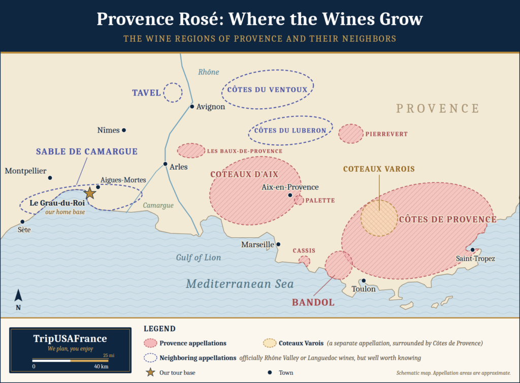
In our post on the wines of the Camargue, we explored the pale vin gris (gray wine) of our home base. Today we travel a little farther east and north to meet the names every rosé lover should know: Côtes de Provence, Coteaux d’Aix-en-Provence, Coteaux Varois, and Bandol, along with smaller appellations like Cassis, Palette, and Les Baux-de-Provence. We also make room for a few neighbors: Tavel, Côtes du Luberon and Côtes du Ventoux. They are officially classed with the Rhône Valley rather than Provence, but their rosés belong in any conversation about the pink wines of the South.
How Is Rosé Made?
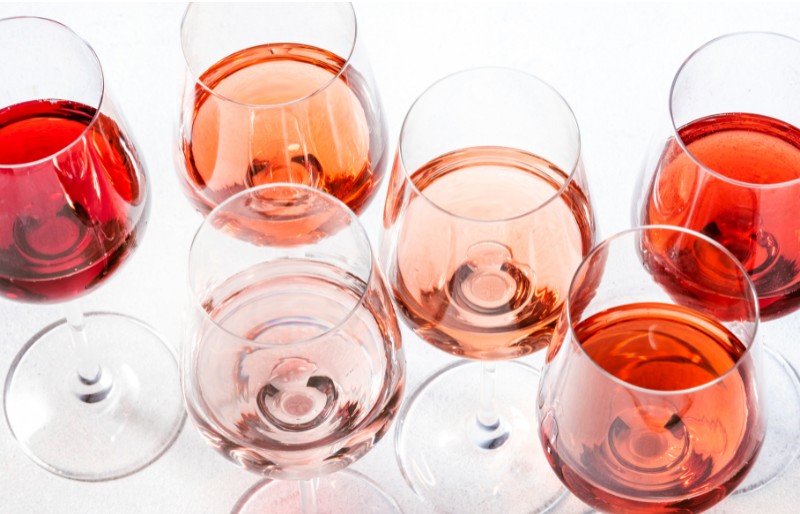
Here is a little secret: the juice of almost every red grape is clear. All the color in a wine comes from the skins. So the shade of a rosé depends on two things. First, which grapes the winemaker uses. Second, how long the juice stays in contact with the skins.
Winemakers have three main ways to make it:
Direct pressing: The grapes go into the press as soon as they reach the winery. The juice picks up just a blush of color. This is the Provence method, and it gives the palest wines.
Short maceration: The crushed grapes rest in their juice for a few hours, sometimes a day or two, before pressing. The longer they wait, the deeper the pink. Tavel is the classic example.
Saignée (bleeding): While making a red wine, the winemaker draws off some of the pink juice early. That juice is then fermented on its own as rosé.
Which Grapes Make Provence Rosé?
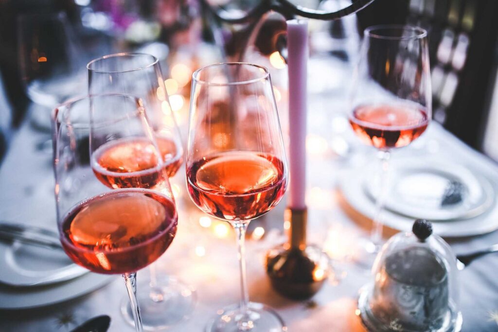
Beyond timing, the grape matters just as much. Thin-skinned varieties like Grenache and Cinsault give a delicate, pale pink. Thicker-skinned grapes like Syrah and Mourvèdre give more color and structure, even with the same timing.
In fact, rosé can be made from almost any red grape. In the Loire Valley, winemakers use Cabernet Franc and Pinot Noir. Spain makes its rosado from Tempranillo and Garnacha, and California is famous for White Zinfandel. Provence has simply made rosé its specialty. Here, the classic blend starts with Grenache and Cinsault. Syrah and Mourvèdre add color and structure, the local Tibouren brings a savory note, and a splash of white Rolle (Vermentino) adds freshness.
One thing rosé is not, at least in Europe: a mix of red and white wine. The rules forbid blending finished red and white wines to make still rosé. Rosé Champagne is the famous exception.
Provence Rosé at a Glance
| Name | Provence Appellation Wine | Where | Color | Main grape | Style | Try it with |
|---|---|---|---|---|---|---|
| Côtes de Provence | Yes | The Var, from Aix-en-Provence toward the Riviera | Pale pink to peach | Grenache and Cinsault | Dry, fresh and fruity | Aperitifs, salads, grilled fish |
| Coteaux d’Aix-en-Provence | Yes | Western Provence, from the Durance River to the sea | Salmon-pink to peach | Grenache and Cinsault | Bright and zesty, with citrus notes | Aperitifs, goat cheese, grilled vegetables |
| Coteaux Varois en Provence | Yes | Hills around Brignoles, in the heart of the Var | Very pale pink to salmon | Grenache and Cinsault | Fresh and elegant, from the highest vineyards | Salads, seafood, roast chicken |
| Bandol | Yes | Terraced hills above the port of Bandol | Pale salmon | Mourvèdre | Fuller and spicy; can age | Bouillabaisse, aïoli |
| Côtes du Luberon & Côtes du Ventoux | No (Rhône Valley) | Vaucluse hills, from the Luberon to Mont Ventoux | Pale to bright pink | Grenache and Syrah | Fresh and fruity, from cool hillsides | Picnics, market lunches, tapenade |
| Tavel | No (Rhône Valley) | The Gard, just across the Rhône from Avignon | Deep pink to light ruby | Grenache and Cinsault | Full and structured, with spice | Grilled lamb, sausages, spicy food |
Want to try the local wines & food specialties?
Join us on a South of France small-group tour.
Why Provence Rosé Tastes Different Here
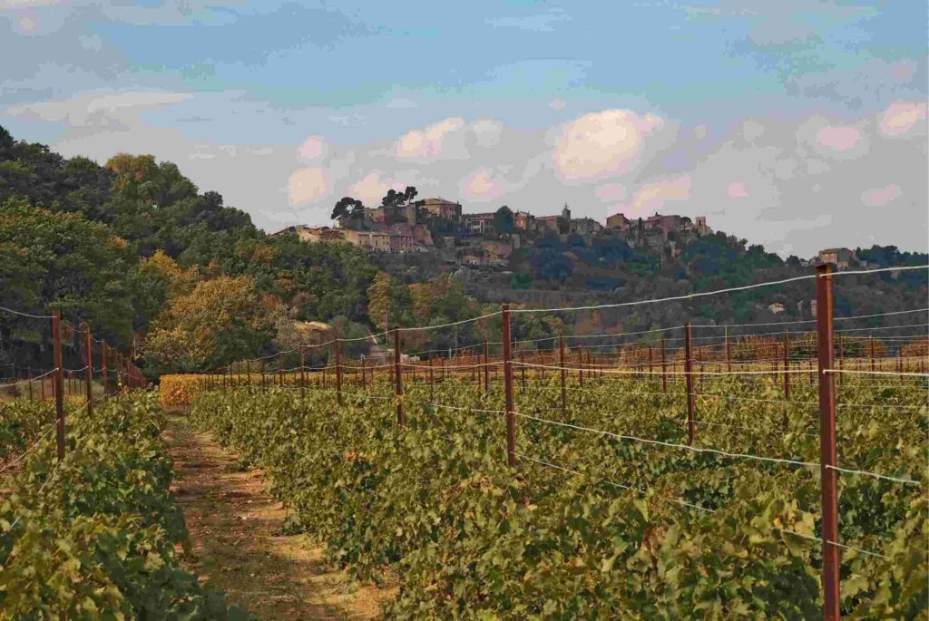
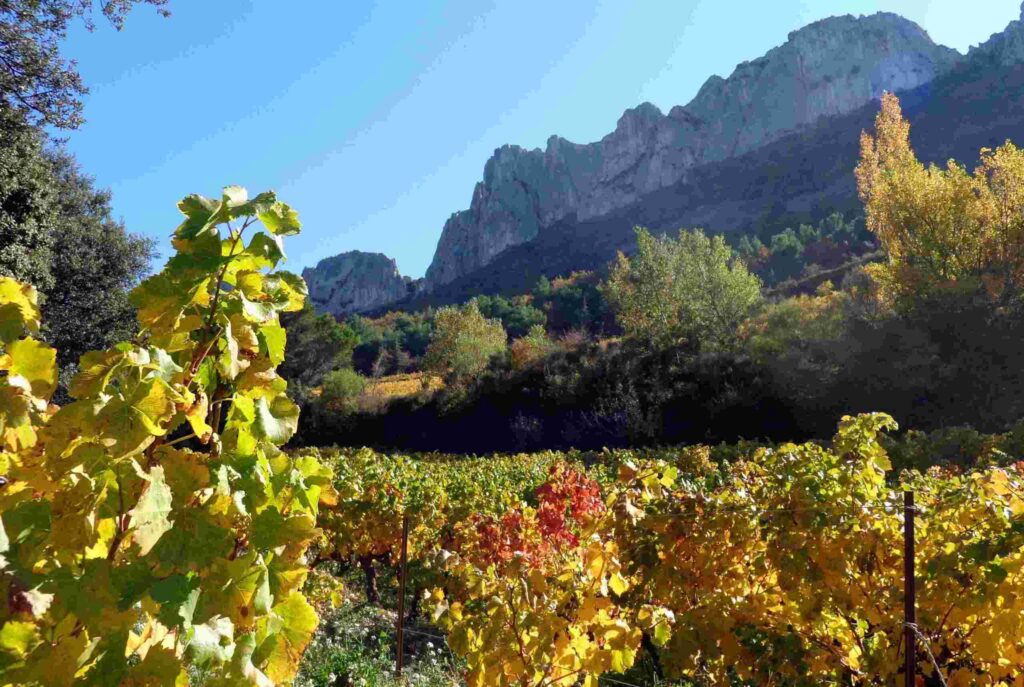
Rosé has deep roots in Provence. Greek sailors planted the first vines here some 2,600 years ago, when they founded Marseille. In those days, winemakers rarely left the juice on the grape skins for long, so most wine was pale. In a sense, Provence rosé is the original wine of France’s oldest wine region.
Today the region still lives for Provence rosé. About 90% of the wine made in the three main Provence appellations is rosé. In 2024 alone, that added up to around 134 million bottles. So what gives it that special taste?
Sun and wind: Long, dry summers ripen the grapes fully. Meanwhile, the mistral (the cold north wind that sweeps down the Rhône Valley) keeps the vines dry and healthy.
Stone and sea: Vines grow in poor, rocky soils, often within sight of the Mediterranean. Poor soil gives small grapes with concentrated flavor.
Picked in the cool of night: Many estates harvest at night or at dawn, while the grapes are still cold. This protects their freshness and bright acidity.
A gentle press: Most Provence rosé is made by pressurage direct (direct pressing). The grapes go straight into the press, so the juice touches the skins only briefly. That is where the famous pale color comes from.
Made to be rosé: Here, rosé is not a by-product of red wine. Winemakers choose their grapes, vineyards and harvest dates for rosé from the very start.
Why It Never Tastes Quite the Same Back Home
There is one more reason, and it has less to do with the vineyard than with the journey. Rosé is a delicate wine. It is made to be enjoyed young, while its fruit is fresh and bright.
To begin with, only part of it ever leaves France. About four in ten bottles of Provence rosé are exported, and the United States buys more than a third of those. The bottles on American shelves tend to come from estates large enough to export. Many small family wineries sell most of their wine at the cellar door and to local restaurants. So yes, in a way, we keep a few treasures for ourselves.
Then there is the trip itself. A bottle may spend weeks crossing the Atlantic, then more time in warehouses and on store shelves. Heat is wine’s worst enemy, and a shipping container can get very hot. Careful importers use refrigerated containers, but not all of them do. By the time a bottle reaches your table, it may be months older and a little tired.
What about preservatives? You may have heard that exported wines get extra sulfites. In fact, almost all wines contain some sulfites, which protect them from spoiling. European rules cap how much a winemaker may use. The “contains sulfites” line on American labels comes from a U.S. labeling law. By itself, it does not mean your bottle was treated differently from one sold in France.
So drink your rosé in Provence: this year’s vintage, a few miles from where it was made, with food grown in the same sun. That is a taste no importer can ship.
Côtes de Provence: The Pale Pink Classic
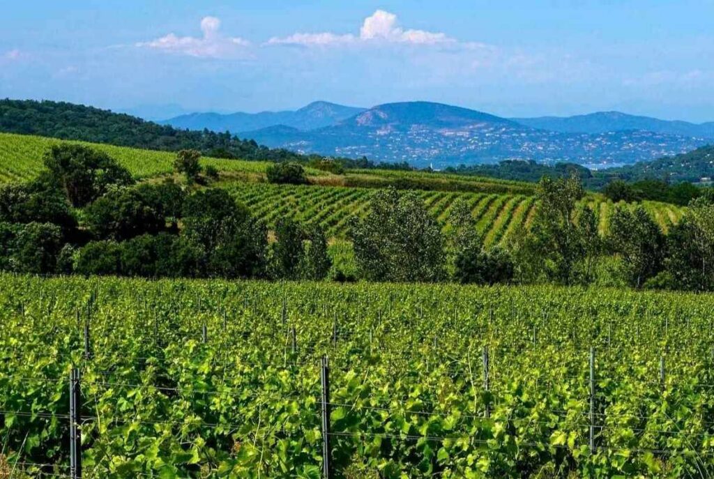
When most Americans picture Provence rosé, they are picturing Côtes de Provence. It is the largest appellation in the region, with around 20,000 hectares (nearly 50,000 acres) of vines. They stretch across the Var, from the edge of Aix-en-Provence to the hills behind the Riviera.
The wine is dry, pale and delicate, the color of a peach or an onion skin. Expect notes of strawberry, white peach, citrus and a hint of garrigue (the wild herbs of the Provençal hills). Tibouren, the old local grape, is a specialty here, especially in the vineyards near the coast.
This is the rosé for long lunches and sunset aperitifs. Serve it well chilled with tapenade, summer salads, grilled fish or petits farcis (Provençal stuffed vegetables).
Bandol: Provence’s Most Serious Rosé
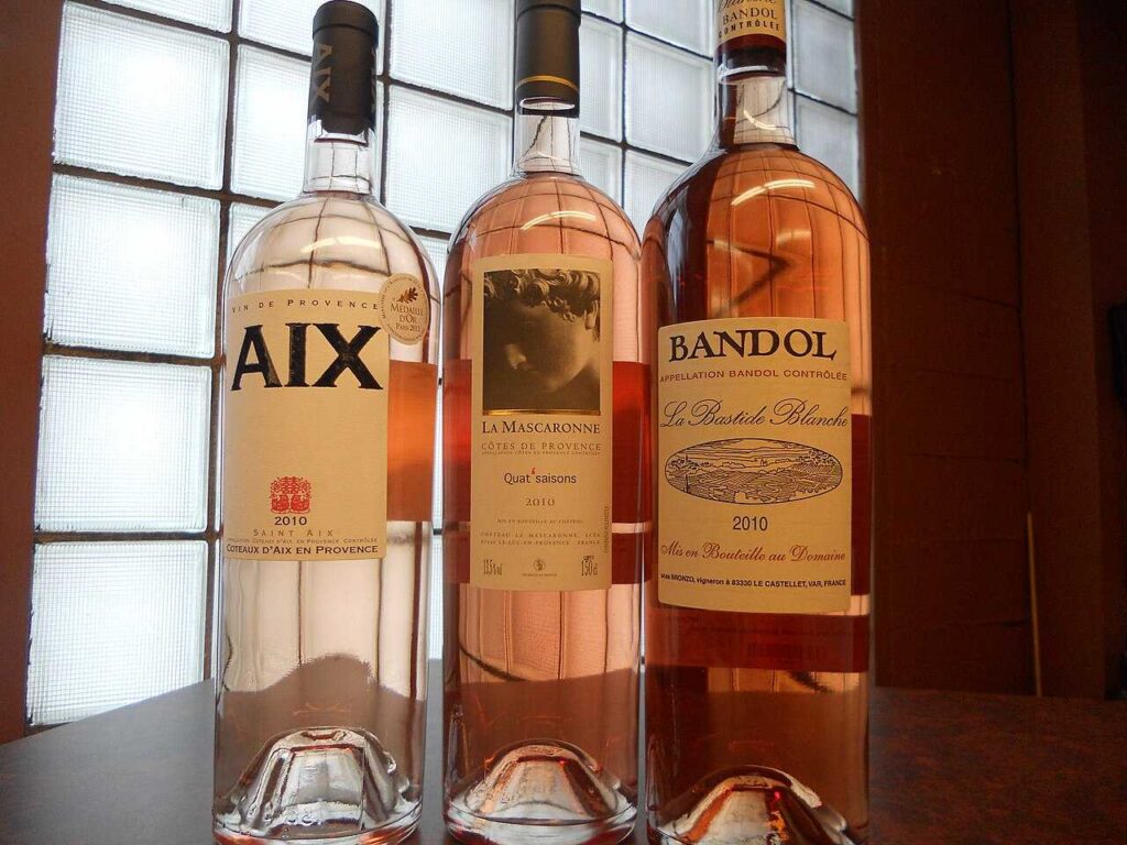
Bandol is a small fishing port between Marseille and Toulon. Behind it, vineyards climb the hills in a natural amphitheater facing the sea. Generations of farmers built stone terraces called restanques to hold the soil on the slopes. Here the vines soak up close to 3,000 hours of sunshine a year.
The secret is Mourvèdre, a late-ripening grape that needs heat and sea air to thrive. By law, every Bandol rosé must contain at least 20% Mourvèdre, and many estates use far more. All grapes must be picked by hand. The appellation dates back to 1941, which makes it one of the oldest in Provence.
The result is a Provence rosé with more body and spice than its neighbors. It still looks pale salmon in the glass. Yet it tastes of red fruit, orange peel and herbs. Unusually for a rosé, a good Bandol can age for several years. We love it with bouillabaisse or a big platter of aïoli (garlic mayonnaise served with cod and vegetables).
“Unusually for a rosé, a good Bandol can age for several years.”
Coteaux d’Aix-en-Provence: Rosé in the Mistral
Head west from the Côtes de Provence and you reach the Coteaux d’Aix-en-Provence. Its 4,300 hectares (about 10,600 acres) of vines stretch from the Durance River down to the sea. At its center sits the elegant city of Aix. Here the mistral blows often and hard. It dries the vines after rain and helps keep them healthy. Today, more than 80% of the vineyards are certified organic or HVE (High Environmental Value).
Winemakers blend Grenache, Cinsault and Syrah with Mourvèdre and Counoise. Some also use Cabernet Sauvignon, which is rare in Provence. The rosés are a bright salmon-pink, with notes of citrus and red berries and a lively, thirst-quenching finish. Both our South of France and Lavender tours spend a day in Aix, right in the heart of this appellation.
Coteaux Varois en Provence: Rosé From the Hills
Inland, in the heart of the Var, lie the Coteaux Varois en Provence. The vineyards surround the market town of Brignoles and cover nearly 3,000 hectares (about 7,400 acres). That makes this the smallest of the three main appellations. It is also the highest, with most vines growing at 300 to 400 meters (1,000 to 1,300 feet). The Sainte-Baume mountains shelter the vines from the sea, so winters are cold and summers are hot.
Rosé makes up more than 90% of the wine here. It pours a very pale pink to salmon. Expect floral and fruity aromas, with a lovely balance of roundness and freshness.
Tavel: The Rosé That Thinks It Is a Red
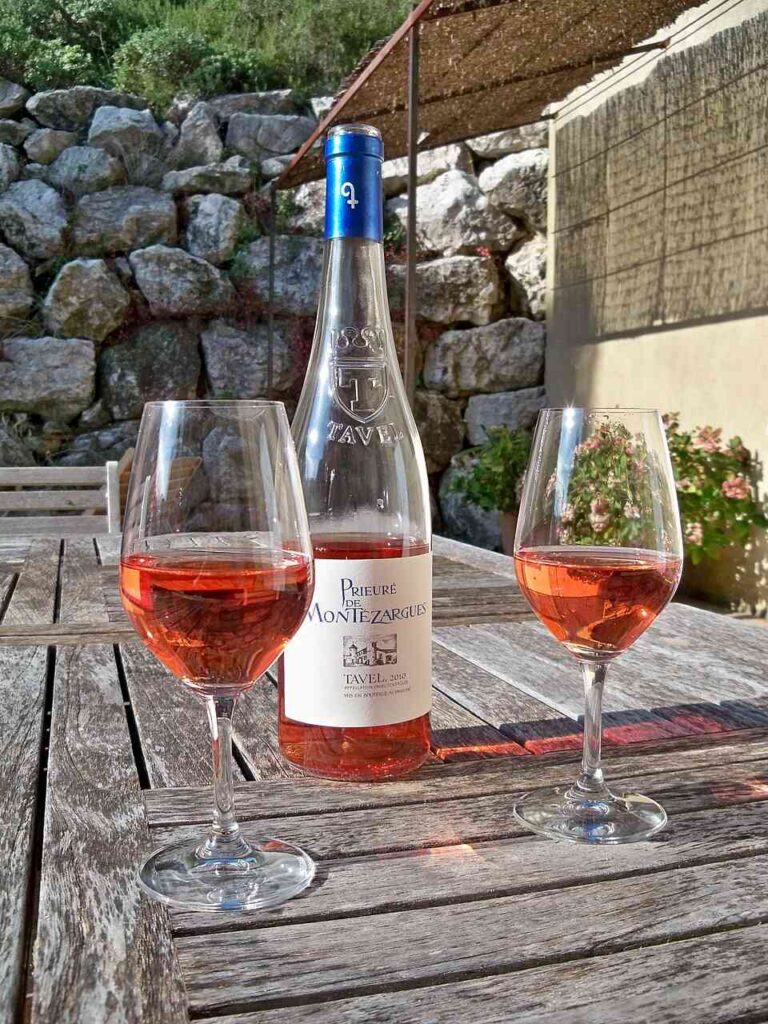
Tavel is not a Provence wine, but it sits so close that no rosé journey through the South would be complete without it. The village lies just across the Rhône River in the Gard, a few miles from both Avignon and the Pont du Gard. Its wine is officially classed as a Rhône Valley appellation, one of the region’s top-ranked crus alongside Châteauneuf-du-Pape.
Tavel was among the very first French appellations, created in 1936, and the first devoted entirely to rosé. (Our Camargue neighbor, Sable de Camargue, joined that club in 2023.) Its vines grow on sand, limestone and the rounded river stones the southern Rhône is famous for.
What makes Tavel different is time. Instead of pressing the grapes right away, winemakers leave the juice on the skins, often for a day or more. As a result, the wine comes out deep pink, sometimes close to ruby. It tastes of cherry, raspberry, almond and spice. Because it has real structure, it pairs happily with grilled lamb, sausages and even spicy food.
Ernest Hemingway was a famous fan. As the story goes, he would not start lunch in New York without a glass of Tavel. Fittingly, he also spent his honeymoon in Le Grau-du-Roi, the seaside town where our 8-Day South of France tour is based.
“Tavel is the rosé that thinks it is a red.”
More Rosés to Discover
Provence also has a few smaller appellations worth a detour. Cassis, beside the Calanques, is famous for its white wine but makes lovely rosés too. Palette, just outside Aix, covers barely 45 hectares (about 110 acres). Les Baux-de-Provence surrounds the hilltop village we visit on both our South of France and Lavender tours. In 2023, it became one of the very first 100% organic appellations in France.
Two more names deserve a place at the table. Like Tavel, the Côtes du Luberon and Côtes du Ventoux appellations officially belong to the Rhône Valley. Yet with their lavender fields, hilltop villages and markets, they feel like Provence through and through. In the Luberon (the valley made famous to Americans by Peter Mayle), rosé is the most-produced color, grown on cool hillsides between 200 and 450 meters (650 to 1,500 feet). Farther north, the Ventoux vineyards climb the lower slopes of Mont Ventoux, the “Giant of Provence.”
Here is a fun detail. Roussillon, where our 8-Day Special Lavender Tour spends three nights, sits inside the Luberon Regional Nature Park. Yet its vineyards belong to the Côtes du Ventoux appellation.
Does Paler Mean Better?
Not at all. The color of a rosé depends on the grapes and on how long the juice touches the skins. It says nothing about quality. A pale Côtes de Provence and a deep Tavel can both be excellent.
In fact, the pale Provence rosé look is now copied around the world. So choose by style rather than shade. Look for fresh acidity, clean fruit and a dry finish. Those are the marks of a good rosé, whatever its color.
How to Drink Rosé Like a Provençal Local
Drink the youngest vintage: Most Provence rosé is best within a year or two of the harvest. Bandol and Tavel are the exceptions.
Keep it cool, not icy: Serve it around 50°F (10°C). If it is too cold, you lose the aromas.
Try a piscine: On very hot days, locals sometimes pour rosé over ice cubes. They call it a piscine (swimming pool), and nobody will judge you.
Order the house carafe: In village restaurants, rosé en pichet (in a small jug) is often local, delicious and a good value.
Visit a cave coopérative: These village wine cooperatives sell local wine at fair prices. You can usually taste before you buy.
Pair it with the South: Rosé loves olive oil, garlic, tomatoes, herbs and seafood. In other words, it loves Provençal food.
Bring some home: Wrap bottles well and pack them in checked luggage. Beyond one liter per adult, U.S. Customs charges a modest duty.
Taste the South of France With Us
Our 8-Day South of France Tour is based in Le Grau-du-Roi, a few minutes from the sandy vineyards of the Camargue. Wine is part of every day of the journey. We visit local estates to meet the people who make it, and regional wines are poured with our group meals. You will taste rosé exactly where it belongs: close to the vines, in the Provençal sun.
Traveling in June? Our Special Lavender Tour pairs the lavender fields with the same love of local food and wine. Both tours travel in small groups, a relaxed and personal way to taste the South.
Explore the 8-Day South of France Tour →
Keep Reading
- Vin des Sables & Vin Gris: The Unique Wines of Camargue
- Camargue: Must See Area of Southern France That Will Surprise You
- South of France Map: Best Places, Food and Hidden Villages
- 11 of the Best Markets in the South of France
- Avignon, Major Attraction in Provence
- 15 Things to Do in Southern France
À bientôt, mes amis
Julia